DownScan Lowrance: Read Bottom Detail with More Confidence
DownScan Imaging gives anglers a photo-like sonar view of the water beneath a boat, helping distinguish bottom features and cover. Learn what the display can—and cannot—tell you, and how to pair it with traditional sonar.
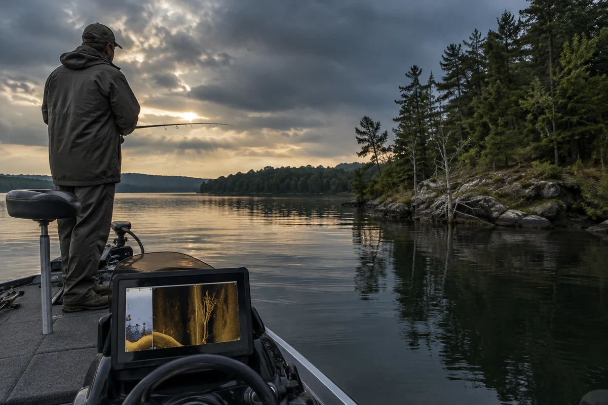
DownScan Lowrance is a term anglers use for Lowrance’s DownScan Imaging sonar view. It presents a detailed, picture-like image of what lies beneath the boat, complementing the arches and depth information of conventional sonar. The practical benefit is not a guaranteed fish finder: it is another way to inspect bottom shape, cover, and possible targets while you decide where and how to fish.
Understanding the difference between the views helps keep the display in perspective. Start with a clear picture of the feature you want to locate, then use the sonar alongside your map, fishing observations, and safe boat handling—not as a substitute for them.
What is DownScan Imaging, and how is it different from traditional sonar?
Traditional sonar commonly shows returns as marks or arches, representing objects as they pass through the sonar beam. DownScan Imaging instead renders a narrow slice beneath the boat in a more photographic style. On supported equipment, both views can be used together: one helps track depth and moving targets, while the other can make bottom contours and submerged cover easier to recognize.
The image is built from sound returns, not a camera photograph. Its appearance depends on the transducer, the unit’s capabilities, settings, boat movement, depth, and conditions. The exact controls and available views vary by model, so consult the manual for your unit rather than assuming every Lowrance display has the same options. Lowrance’s product information is a useful starting point for confirming which imaging features a particular model supports.
This distinction matters when a display seems to show a fish clearly. Sonar can return a signal from a fish, vegetation, timber, rock, or other object; an image alone may not identify it with certainty. Use conventional sonar and DownScan as complementary evidence, not competing promises.
What kinds of structure can the view help you identify?
DownScan can help anglers inspect changes in bottom shape and distinguish types of cover. Depending on conditions and equipment, a display may make edges, harder bottom, vegetation, brush, or other submerged features easier to see. A useful question is not simply “Is that a fish?” but “What kind of place is this, and could it hold fish under today’s conditions?”
Look for repeatable patterns: a distinct transition between bottom types, a boundary where vegetation ends, or an isolated object beside a drop. Compare the feature with the depth reading and chart. If you pass over it again from another direction and the signal changes substantially, boat path, orientation, or settings may be affecting the image.
Sonar does not tell you whether a location is open to fishing, safe to navigate, or likely to produce a bite. Check local rules and use appropriate navigation practices. A visible shape can also be difficult to classify at speed or in challenging conditions; slow down and make another pass when it is safe and useful to do so.
How should you set up the display for a useful first pass?
Begin with the transducer and display setup recommended in the equipment manual. A poorly mounted or obstructed transducer, turbulent water, or unsuitable installation can compromise returns. Check that the unit is configured for the transducer actually in use, and learn the basic controls before relying on the image on the water.
For an initial scan, choose a familiar area and a steady, safe boat speed. Keep the view uncluttered: set a readable range and sensitivity, then adjust one control at a time if the image is too faint or crowded. There is no universal setting that fits every depth, bottom, transducer, and model. If the display is noisy, first check installation, connections, and the manual’s troubleshooting guidance rather than making several unrelated adjustments at once.
Save or mark a useful location only after confirming it against the chart and your surroundings. A waypoint records where the boat was when the mark was made; it does not guarantee that the object is precisely beneath that point or that the spot remains safe at a different water level. Keep attention on traffic, weather, and navigation while operating the equipment.
How do you interpret marks without mistaking them for fish?
Treat the display as clues, not labels. A fish-like return may be a fish, but the sonar image alone cannot establish species, size, or whether the target is catchable. Compare DownScan with traditional sonar, note the depth and location, and watch whether the mark changes as you pass. Familiarity comes from observing repeated returns in places whose bottom and cover you can verify by other means.
Separate the background from the target. First identify the general bottom line and any rise, depression, or cover extending from it. Then notice returns that stand apart from that structure. A stronger or more defined mark is not automatically a fish; settings, distance, and conditions affect how objects appear. Resist assigning a precise identity based on a single screen capture.
Use a repeat pass to test your interpretation, not to chase a perfect picture. If a feature is worth fishing, choose a presentation suited to the species, depth, and cover, and adjust based on contact and conditions. Anglers considering a compact presentation around structure may also find this overview of a swivel-head jig useful; sonar can inform where to explore, but it does not choose the lure for you.
How can you combine DownScan with maps and fishing tactics?
A chart helps you select a route and identify likely contours; sonar lets you inspect what is actually returning beneath the boat. Use the map to form a hypothesis—perhaps a break, channel edge, or point—and scan it methodically. When the display shows an interesting change, record its position and compare it with the chart rather than treating either source as complete by itself.
Plan a drift or pass that lets you cover the feature safely and consistently. Wind, current, water level, and boat control can change where a lure travels relative to the sonar mark. If you are fishing a river, for instance, the relationship between current and bottom structure is part of the presentation; this guide to a river carp rig offers a separate look at rig considerations in that setting.
For bait fishing, electronics can help locate useful depth or cover, while bait condition and handling remain separate concerns. A minnow bucket design overview can help you think about keeping live bait in suitable condition. None of these tools replaces local regulations, species knowledge, or careful observation.
What are the limits, and what is a practical learning routine?
DownScan is only as useful as the returns and interpretation behind it. It does not show everything in the water, identify every object, or provide a guarantee of fish. Performance can vary with equipment, installation, depth, boat movement, and conditions. A screen can also distract from hazards, so keep a lookout and follow boating safety practices whenever you are underway.
Build skill in short, repeatable sessions. First scan a familiar area and note the depth and visible bottom changes. Make a second pass over one feature, compare the DownScan image with traditional sonar, and record what seems consistent. Later, compare those observations with what you encounter while fishing. Keep notes by location and conditions, but avoid treating one day’s image as a permanent description of a changing lake or river.
For model-specific setup, feature compatibility, and control definitions, use the owner’s manual and official Lowrance information. For broader freshwater technique and equipment context, visit the freshwater fishing tips hub. With practice, DownScan becomes most valuable not as an answer machine but as a careful way to examine underwater structure and make better-informed fishing decisions.
Frequently asked questions
Does DownScan Imaging show fish?
It can display returns that may be fish, but it cannot identify every target with certainty. Compare the image with traditional sonar, depth, location, and repeated passes.
Is DownScan the same as traditional sonar?
No. DownScan presents a detailed, picture-like view beneath the boat, while traditional sonar commonly displays returns as marks or arches. Supported units may show the views together.
What settings should I use for DownScan?
There is no universal setting for every model and condition. Confirm the transducer and unit setup, start with a readable range and sensitivity, and adjust controls gradually using the owner’s manual.
Sources & further information
Consult these primary sources for current regulations, technical information and local guidance.